 Larry Cosgrove
"Is the forecast for a switch to a much colder pattern for real?
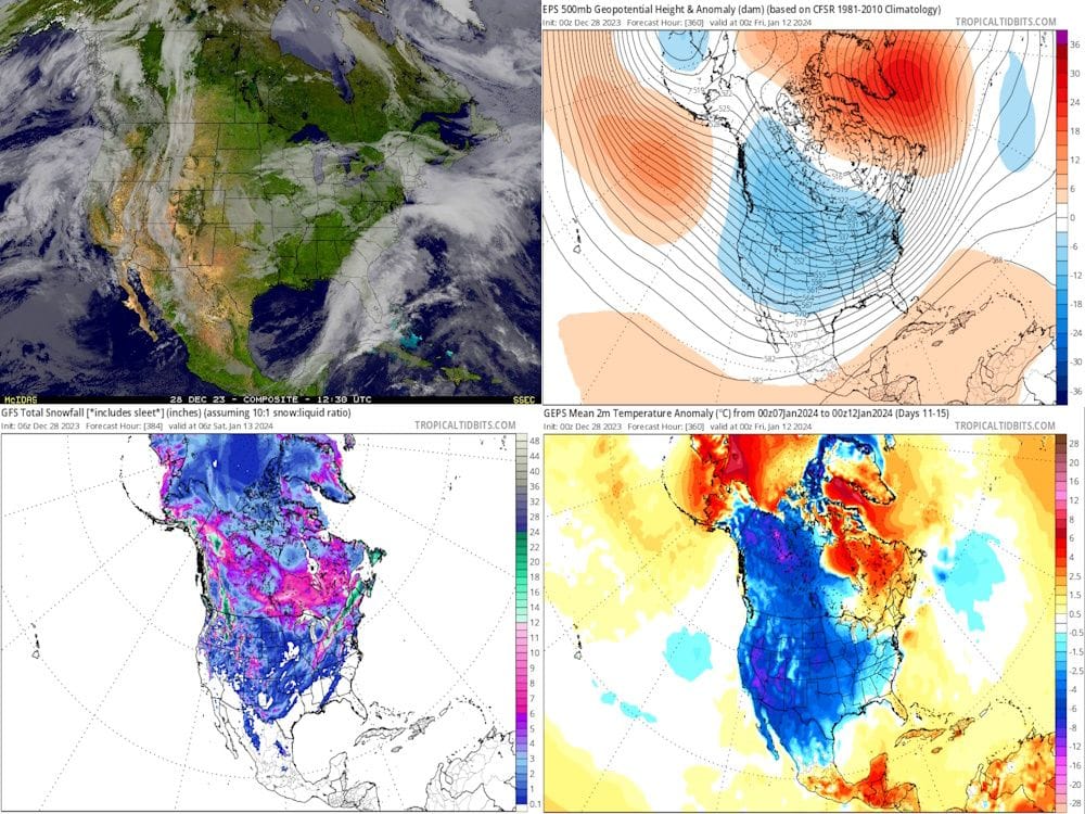
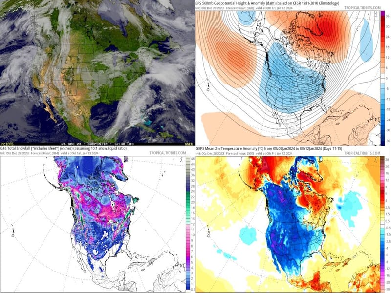
Anyone watching the numerical model forecasts yesterday and this morning is probably doing a double-take. After all, the schemes and the respective ensemble members were showing what seemed like endless warmth across the entire continent. Media and official sources talked endlessly about a mild winter. But then chatter started popping up about the likely decline of El Nino and a major stratospheric warming event in the Northern Hemisphere. Which leads to this discussion.
Yes, I do believe that the rapid amplification of the upper air pattern is correct. It is almost a perfect match for the January analog sets, and if true will mean an expanded snow cover across the lower 48 states and a likely depression of the nocturnal freeze line into Mexico and the Gulf Coast. But I would be careful of the advance of the colder air at surface, as I do not believe that the East Coast will get into the cAk values until after the 15th of next month. Curiously, the southern branch storm track may enable some minor snow or sleet in Texas and parts of the Dixie states just before the plunge of cold readings into the U.S.
This is a pattern that allows for significant cold and storms. If the comparison test scenarios are right, the opportunity for wintry conditions will be to the right of the Continental Divide and mostly along and below the Interstate 90 corridor between January 15 and February 28. As 1973 is a heavy influence in the analog creation, I lean toward a rapid warming in March."